Source to Sea: Maine's Sandy & Kennebec Rivers
Explicit content warning
10/24/24 • 43 min
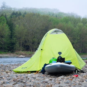
25 years ago the Edwards Dam was removed from the Kennebec River in Maine allowing alewives and sturgeon to return to their spawning grounds in force, revitalizing the ecosystem and delighting the paddlers and local communities with the sturgeons’ explosive breaching displays. In the summer of 2024, 2 separate source to sea trips ran the lengths of the Sandy and Kennebec in Maine. Contributing host Clark Tate was part of the Sandy trip and tells the on river story of both source to sea trips.
CONTRIBUTING HOST
Clark Tate
@lclarktate
RIVERS FOR CHANGE
@riversforchange
www.riversforchange.org
2024 Sandy to Kennebec Confluence
GUESTS
Stuart Hickey, raft guide
@freeheelinghickey
Jessica Sterling, kayak instructor and web designer
@jester1ing
Chris Morgan
@ccmorgan8
Jennifer Noll
Maine Department of Marine Resources
Saige Purser
@saigelinsay
River Radius Podcast - Native Teen Guide In Training Program
Joe Klementovich, Photographer
@klementovich klementovichphoto.com
River Radius Podcast - Source to Sea on the Saco River
Matt Palmariello
@mattpalmariello
www.mainepaddling.com
Amy Borch, Tattoo artist
@amy.wildhand
@melontrout.tattoo
Eli Studer, Tattoo artist
@elistudertatto
www.elistudertatto.com
SPONSORS
Denver Area Nissan Dealers
@nissanusa
Over It Raft Covers
@overitraftcovers
promo code, free shipping: riverradius
SANDY RIVER INFORMATION
Sandy River Northern Forest Canoe Trail Map
Environmental Geology Along the Sandy River, Farmington Maine, Field Trip from University of Maine at Farmington. Dr. Tom Eastler, Mr. Andy Buckland, Mr. Joel Sproul
Indigenous Land and Water Acknowledgement by the University of Maine at Farmington
The Rangeley Area: A Geologic Tour by Emma Stattelman and Katarina Dickson
SEA-RUN FISH INFORMATION
Finding the Next Sebasticook - National Oceanic and Atmospheric Administration
Map of Atlantic SalmonHabitat - Maine Department of Marine Resources
Kennebec River Management Plan Diadromous Resources Amendment - Maine Department of Marine Resources
Historical Fish Trap Counts - Maine Department of Marine Resources
KENNEBEC DAM RELICENSING INFORMATION
Draft Environmental Impact Statement
The written comments are posted on the FERC elibrary website under docket P-2322.
Previous Episode

What is a River 2024: Chilcotin River Landslide, Dam & Breach
In the summer of 2024, the Chilcotin River in British Columbia had a landslide that completely blocked the river creating a natural dam. For the next 6 days the river water backed up behind this dam until the waters finally worked over the top the of the landslide, creating a breach that would exceed the previous historical flows by 5 fold. 3 people share their experience and knowledge of the landslide in this episode.
EPISODE GUESTS
TŜILHQOT’IN National Government
Jenny Philbrick, Executive Director
State of Local Emergency Declared for Tŝilhqot’in Territory due to Tŝilhqox (Chilcotin River) Landslide
Tŝilhqot’in National Government initiating Emergency Salmon Task Force
ROAM Rivers, Oceans and Mountains
Brian McCutcheon
British Colombia Ministry of Water, Land and Resource Stewardship
Natasha Cowie, Hydrologist, River Forecast Centre
TIME LAPSE IMAGES OF LANDSLIDE AND BREACH & other info on landslide
Scroll down to "Timelapse..."
YOU TUBE VIDEOS
Short: "...helicopter view of landslide..."
Short: "...building washed away..."
"Water begins moving past landslide damming Chilcotin River"
River Radius Instagram and Facebook has videos also.
Links below.
EPISODE SPONSORS
THE RIVER RADIUS
Next Episode

Is Public Access to Georgia’s Rivers Disappearing?
Georgia has rivers and streams running from the mountain country of the Southern Appalachians to the Gulf of Mexico, totaling about 70,000 total miles of waterways. Whitewater and flatwater. Clear water and Black water. And a long history of publicly accessible rivers and streams. That access is being debated by the State of Georgia and bills have been proposed that would curtail access for the public. We talk with Georgia Rivers to learn more about this topic and about the public meeting and comment process.
SPONSORS
Denver Area Nissan Dealers
@nissanusa
Over It Raft Covers
@overitraftcovers
promo code, free shipping: riverradius
GUEST
PUBLIC MEETING
Wednesday, Nov. 13, at 9 a.m. in Newnan Donald W. Nixon Centre for Performing and Visual Arts in Newnan, GA.
Email your comments / Georgia Residents
Email your comments / Non Georgia Residents
THUMBNAIL IMAGE
Pic credit, Joe Cook, Georgia Rivers
Flint River, Georgia, Fall 2024
THE RIVER RADIUS
If you like this episode you’ll love


Episode Comments
Generate a badge
Get a badge for your website that links back to this episode
<a href="https://goodpods.com/podcasts/the-river-radius-podcast-445841/source-to-sea-maines-sandy-and-kennebec-rivers-76920985"> <img src="https://storage.googleapis.com/goodpods-images-bucket/badges/generic-badge-1.svg" alt="listen to source to sea: maine's sandy & kennebec rivers on goodpods" style="width: 225px" /> </a>
Copy