Rangiriri Pā
09/06/18 • 40 min
EPISODE SUMMARY: On this episode of Indigenous Urbanism we visit Rangiriri Pā, and the site of a new symbolic reinterpretation developed in reverence to the original pā footprint, and as a setting for continued education about the Battle of Rangiriri and the subsequent invasion of the Waikato.
GUESTS: Moko Tauriki, Dean Whiting, Sam Bourne
FULL TRANSCRIPT:
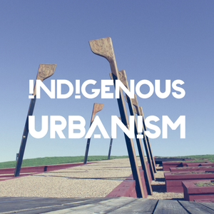
Jade Kake: If you look over to your right on State Highway 1, about 45 minutes north of Hamilton, you’ll see a site of cultural and historical significance. The wetlands and Pou mark the site of a pivotal battle in the 1863 Waikato land wars - The Battle of Rangiriri.
Dean Whiting: So where we're standing at the moment, Rangiriri Pā, so this was the pā that, where one of the major battles, Waikato-Tainui and the British troops that were coming through from Auckland. So there were a series of battles that happened down that line.
JK: In more modern times the significance of the site was overshadowed by the expansion of State Highway 1.
DW: There was a huge cutting through the space, that cut right through the centre of the Pā site.
JK: But now a collaboration between Waikato-Tainui, the New Zealand Transport Agency, and Heritage New Zealand has seen the repatriation of this significant site.
Sam Bourne: When the opportunity came up to re-align State Highway one, that also opened up this opportunity to reimagine and acknowledge the damage that had been done in the past to the pā site, but also make that lineal infrastructure in service to that cultural landscape, and the story of Rangiriri, and the story of the battle that took place there.
JK: Tēnā koutou katoa
Nau mai haere mai ki te Indigenous Urbanism, Aotearoa Edition, Episode 12.
I’m your host Jade Kake and this is Indigenous Urbanism, stories about the spaces we inhabit, and the community drivers and practitioners who are shaping those environments and decolonising through design.
On this episode of Indigenous Urbanism we visit historic Rangiriri Pā, and the site of a new symbolic reinterpretation developed in reverence to the original pā footprint, and as a setting for continued education about the Battle of Rangiriri and the subsequent invasion of the Waikato.
We spoke with Moko Tauariki nō Ngati Naho, who was the Waikato-Tainui lead for the Project.
Kia ora Moko. Thank you so much for agreeing to be on the podcast. Just to start off with, ko wai koe? nō hea koe?
Moko Tauariki: Ko Taupiri te maunga, Waikato te awa, Waikato te iwi, Tainui te waka, Mourea te marae, Ngāti Naho te hapū, ko Moko Tauariki taku ingoa.
JK: Rangiri is a really significant site for Waikato and for all of New Zealand. Could you tell us a little bit about the significance of that site to your hapū and to your wider iwi?
MT: The significance of Rangiriri to Ngāti Naho, Ngāti Hine, Ngāti Pou, Ngāti Mahut - Ngāti Mahuta ki uta - is that it's a place where many of our ancestors stood in defiance of an imminent invasion by the Crown, and basically made their sacrifices there. And so, it's significant to us today because we are actually the kaitiaki that takiwa, of that place, now. Which has been, I guess since the invasion of Rangiriri in 1863, has been under the ownership and the administration, if you like, of the Crown, right up until 2016 when we actually had that particular site handed back to Waikato-Tainui. The invasion into Waikato begins, if you like, at Mercer. That we currently know as Te Pina. And it's probably appropriate for me to focus a little bit on Te Pina, in terms of its significance to Te Puia. And so Te Puia, for many people would know her as the lady who established a cultural kapa haka group called Te Pou o Mangatawhiri. And that group was named after a significant that King Tawhiao did, prior to the invasion of Rangiriri, and he did that on the banks of a stream called the Mangatawhiri stream, which basically is a tributary to the Waikato river. And that became our aukati, or our landmark, and basically signalled to the Crown that you go past this particular landmark, where I have placed my pou, then you declare war. You declare an invasion into Waikato. And so in 1863, General Duncan Cameron, under the orders of Governor Grey, said, well up yours natives, we are the much superior power than you, so we will take this land by force. We challenge you to be rebellious against the Queen of England, and the inception of the Kīngitanga was certainly a threat to that. And so in the month of July, and in actual fact it was on the 12th of July of 1863, Te Pine, or Mercer, was invaded. They then continued to sack, or to invade, occupy other pā sites towards Rangiriri, and in particular Te Tiotio Pā, Te Koheroa Pā, and Meremere Pā. So these are all locations that anybody driving between Auckland and Rangiriri, they would naturally drive past these sites, without a second thought even...
EPISODE SUMMARY: On this episode of Indigenous Urbanism we visit Rangiriri Pā, and the site of a new symbolic reinterpretation developed in reverence to the original pā footprint, and as a setting for continued education about the Battle of Rangiriri and the subsequent invasion of the Waikato.
GUESTS: Moko Tauriki, Dean Whiting, Sam Bourne
FULL TRANSCRIPT:
Jade Kake: If you look over to your right on State Highway 1, about 45 minutes north of Hamilton, you’ll see a site of cultural and historical significance. The wetlands and Pou mark the site of a pivotal battle in the 1863 Waikato land wars - The Battle of Rangiriri.
Dean Whiting: So where we're standing at the moment, Rangiriri Pā, so this was the pā that, where one of the major battles, Waikato-Tainui and the British troops that were coming through from Auckland. So there were a series of battles that happened down that line.
JK: In more modern times the significance of the site was overshadowed by the expansion of State Highway 1.
DW: There was a huge cutting through the space, that cut right through the centre of the Pā site.
JK: But now a collaboration between Waikato-Tainui, the New Zealand Transport Agency, and Heritage New Zealand has seen the repatriation of this significant site.
Sam Bourne: When the opportunity came up to re-align State Highway one, that also opened up this opportunity to reimagine and acknowledge the damage that had been done in the past to the pā site, but also make that lineal infrastructure in service to that cultural landscape, and the story of Rangiriri, and the story of the battle that took place there.
JK: Tēnā koutou katoa
Nau mai haere mai ki te Indigenous Urbanism, Aotearoa Edition, Episode 12.
I’m your host Jade Kake and this is Indigenous Urbanism, stories about the spaces we inhabit, and the community drivers and practitioners who are shaping those environments and decolonising through design.
On this episode of Indigenous Urbanism we visit historic Rangiriri Pā, and the site of a new symbolic reinterpretation developed in reverence to the original pā footprint, and as a setting for continued education about the Battle of Rangiriri and the subsequent invasion of the Waikato.
We spoke with Moko Tauariki nō Ngati Naho, who was the Waikato-Tainui lead for the Project.
Kia ora Moko. Thank you so much for agreeing to be on the podcast. Just to start off with, ko wai koe? nō hea koe?
Moko Tauariki: Ko Taupiri te maunga, Waikato te awa, Waikato te iwi, Tainui te waka, Mourea te marae, Ngāti Naho te hapū, ko Moko Tauariki taku ingoa.
JK: Rangiri is a really significant site for Waikato and for all of New Zealand. Could you tell us a little bit about the significance of that site to your hapū and to your wider iwi?
MT: The significance of Rangiriri to Ngāti Naho, Ngāti Hine, Ngāti Pou, Ngāti Mahut - Ngāti Mahuta ki uta - is that it's a place where many of our ancestors stood in defiance of an imminent invasion by the Crown, and basically made their sacrifices there. And so, it's significant to us today because we are actually the kaitiaki that takiwa, of that place, now. Which has been, I guess since the invasion of Rangiriri in 1863, has been under the ownership and the administration, if you like, of the Crown, right up until 2016 when we actually had that particular site handed back to Waikato-Tainui. The invasion into Waikato begins, if you like, at Mercer. That we currently know as Te Pina. And it's probably appropriate for me to focus a little bit on Te Pina, in terms of its significance to Te Puia. And so Te Puia, for many people would know her as the lady who established a cultural kapa haka group called Te Pou o Mangatawhiri. And that group was named after a significant that King Tawhiao did, prior to the invasion of Rangiriri, and he did that on the banks of a stream called the Mangatawhiri stream, which basically is a tributary to the Waikato river. And that became our aukati, or our landmark, and basically signalled to the Crown that you go past this particular landmark, where I have placed my pou, then you declare war. You declare an invasion into Waikato. And so in 1863, General Duncan Cameron, under the orders of Governor Grey, said, well up yours natives, we are the much superior power than you, so we will take this land by force. We challenge you to be rebellious against the Queen of England, and the inception of the Kīngitanga was certainly a threat to that. And so in the month of July, and in actual fact it was on the 12th of July of 1863, Te Pine, or Mercer, was invaded. They then continued to sack, or to invade, occupy other pā sites towards Rangiriri, and in particular Te Tiotio Pā, Te Koheroa Pā, and Meremere Pā. So these are all locations that anybody driving between Auckland and Rangiriri, they would naturally drive past these sites, without a second thought even...
Previous Episode
Ngāruawāhia Papakāinga
EPISODE SUMMARY: On this episode of Indigenous Urbanism we visit the Ranga-Bidois whānau of Waikato-Tainui, who have bought back their ancestral land in Ngāruawāhia and have worked together as a whānau to re-establish papakāinga.
GUESTS: Trevor Ranga, Poppy Ranga
FULL TRANSCRIPT:
Jade Kake: Ngāruawāhia. Heart of the Waikato, and home of the Kīngitanga. Today, Waikato-Tainui is known as one of the most prosperous iwi in the country, but it hasn’t always been this way. The raupatu or confiscation of millions of acres of tribal territory during the land wars of the 1860s, saw the tribe become almost landless in their own rohe.
Trevor Ranga: For us, being raupatu land, it’s about us gaining back what was lost, so the whenua, and everything that comes with the whenua, all the learnings, all the skills that were developing to help our family to become leaders in this field.
Poppy Ranga: Papakāinga for me is about us looking after each other so that we can look after others, and also it's about tuku iho. So, this land found us as far as I'm concerned. So we're now looking after it so that it can find others too. And whether that means in the material world or whatever world, you know, doesn't mean to say that, but it's about us trying to look after ourselves so that we can look after, and to me papakāinga has been whānau ora. For us looking after ourselves, looking after our family. We definitely believe in that kaupapa, whānau ora.
JK: Tēnā koutou katoa
Nau mai haere mai ki te Indigenous Urbanism, Aotearoa Edition, Episode eleven.
I’m your host Jade Kake and this is Indigenous Urbanism, stories about the spaces we inhabit, and the community drivers and practitioners who are shaping those environments and decolonising through design.
On this episode of Indigenous Urbanism, we visit the Ranga-Bidois whānau nō Tainui, who bought back their ancestral land in Ngāruawāhia and have worked together as a whānau to re-establish papakāinga.
We spoke with mother and son whānau project team, Trevor and Poppy Ranga.
TR: Yeah we were like a team, she took care of the social behaviours, and I took care of the technical aspects.
Nazarene Mihaere nō Tūwharetoa raua ko Tainui is our special reporter for this story.
TR: Kia ora. Ko Trevor tāku ingoa. Nō Kawhia Moana ahau. E noho ana ki Ngāruawāhia. So, in 2007 we had dreams to come together and work together as a whānau to stop the fragmentation that was happening in terms of our whānau structure, whānau ora. We were on our own individual ventures, trying to pretty much establish ourselves in the mainstream. And there were a couple of incidents or issues that arose when we went to go and purchase our own homes. And it just wasn't panning out for us. At the time there were so many barriers in the way, that we needed to look at how we were trying to achieve those home ownership goals. So we were gifted this whenua - well we say it's gifted, because we were up against so many other people, including the developers. But the ex-homeowner's really liked us and our vision, and what we wanted to bring here was all about families and communities. Yeah, so that was pretty much what dot us here. We ended up going through a pilgrimage, and looking at the possibilities on how we manage to obtain it, and when we did some background and some whakapapa mahi, we found out that our tūpuna had mana whenua over the land here. And how we found out is by that hill over there, there was a pā site up on the hill there, and it was called Puke Ahua, and so that's where one of our tūpuna had settled. And that’s where the name Ngāruawāhia came from, that hill.
Nazarene Mihaere: You’ve mentioned that we’re standing on a papakāinga. Do you want to explain to those of us who don't know what a papakāinga is, what a papakāinga is?
TR: Yeah, there's lots of understandings around papakāinga, but for us it's about whanaungatanga, it's about connecting as a whānau again, re-establishing some tikanga, some new ways of coping really, in the ever changing world that's happening. Things are moving so fast we tend to get caught up in the grind of everyday life. So with us being here together we can keep each other grounded, build relationships, and also have our own space, while we're here. And also for us, papakāinga is about papa, which is the foundation, and building that foundation and then the kāinga is like the kai, and how we eat it. This is my own interpretation. So it's about looking after our resources, and how does that look. Well, you've got to look at how you use it, how you grow it, nurture it, manaaki it. So yeah, that's what papakāinga is for us.
NM: Now that we’re walking down the papakāinga, how did you guys get your street name, Ania Way?
TR: Yeah, it wasn't actually a long journey to get there. It was a bit of common sense I suppose.
Poppy Ranga: It was, because ...
Next Episode
In Conversation with Kevin O'Brien
EPISODE SUMMARY: On this episode of Indigenous Urbanism, we speak with Kevin O’Brien, an architect from the Meriam and Kaurareg people of the Torres Strait, Australia. In his work, Kevin has explored a wide range of architectural processes that consider the emptying of the city in order to reveal Country.
GUESTS: Kevin O'Brien
FULL TRANSCRIPT:
Jade Kake: Tēnā koutou katoa
Nau mai haere mai ki te Indigenous Urbanism, Aotearoa Edition, Episode 13.
I’m your host Jade Kake and this is Indigenous Urbanism, stories about the spaces we inhabit, and the community drivers and practitioners who are shaping those environments and decolonising through design.
On this episode of Indigenous Urbanism we speak with Kevin O’Brien, an indigenous architect practicing in Brisbane, Queensland, Australia. Kevin belongs to the Meriam and Kaurareg peoples of the Torres Strait, a group of islands located in north-eastern Australia.
To kick off, could you tell me who you are, where you're from, and what you do?
Kevin O'Brien: My name is Kevin O'Brien. I'm a descendant of the Kaurareg and Meriam people from the Torres Strait. I'm an architect, practising in Brisbane, and I’m Professor of Creative Design at the University of Sydney.
JK: How did this relationship and collaboration internationally start? And how is this kind of sharing and dialogue influenced your practice?
KOB: So I think this set of relationships that have developed for me have taken almost 20 years to happen. It started with a guy called Rewi Thompson, up in Auckland, but we actually met in Sydney at a student conference back in the late 90s. And at the time I was working with one other Aboriginal man in Australia, also in Sydney, another architect. And at the time we were the only two. And then we met Rewi, and we thought, oh maybe there's three of us. And we hadn't at any point really looked outside of where we were in Sydney. We were quite young at the time, and we were just trying to get by. Then as we met Rewi we met other people over here, and then slowly but surely over the last 20 years it's been sort of dripping, dripping, dripping, dripping, and the dripping's turning into a bit more of a flow now. And finally, sort of early 2000s we started to meet people up in Canada and the States, and the network sort of started to... you know, it was nice and social and easy and it's just sort of grown and grown. And then I think in the last 12 months it hit some kind of tipping point, which was fantastic, because it's ended up in a really big sort of critical mass between Australia, New Zealand and Canada. One of the fruits of that growing is I think this book that's just about to be published.
JK: Something that is a recurring theme between our countries being settler-colonial nations is this real tension between rural and hau kāinga, like home communities, that might be quite geographically isolated from the urban centres where a lot of our people now live. So I'm just wondering, how do you kind of navigate that as an architect, and how your approaches might be different on Country versus being in these colonised cities.
KOB: I think in the Australian setting, we've got a quilt work of Aboriginal countries across the continent, and then in understanding that, then it's easy to understand the two roles, or the two hats we wear, as architects. Because one is as a professional architect, in the modern sense, but there's something that informs that in terms of an obligation as an Aboriginal man, and that is that you have expectations and cultural obligations. And one of them is to understand precisely what Country you're standing on, before you do anything. Once you're aware of that as a starting point, it does two other things. One is it helps you to look inside yourself and understand who you are, but more importantly, you can only really do that if you have genuine relationships with the people of that place. So once those things are kind of set out, and they develop over time as well, the architecture can then be enabled and followed. So, what I tend to find is, from observing other people and other architects and how they practice, they tend to strike difficulty when they don't have those relationships, or they don't know themselves, or they try to impose work onto a community or onto a place.
JK: And they imagine maybe sometimes a cultural blankness, I think that comes with being, you know, a colonising group.
KOB: To be honest, it's not bound to one culture or the other. I've seen this [from] fellow Aboriginal people, and also non-Aboriginal people. And, it's not one easily explained, but in my experience I've seen some of that occur purely out of, not a lack of maturity, but someone who's in the process of maturing, and they're finding out or starting from a point of naivety, but they're on a search to get to another place. And inevitably, mistakes...
If you like this episode you’ll love


Episode Comments
Generate a badge
Get a badge for your website that links back to this episode
<a href="https://goodpods.com/podcasts/indigenous-urbanism-68738/rangiriri-p%c4%81-3641779"> <img src="https://storage.googleapis.com/goodpods-images-bucket/badges/generic-badge-1.svg" alt="listen to rangiriri pā on goodpods" style="width: 225px" /> </a>
Copy